
Merkez Mahalle topographic map
Interactive map
Click on the map to display elevation.
About this map
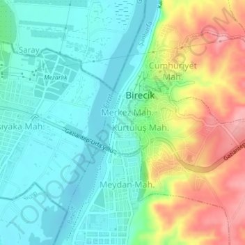
Name: Merkez Mahalle topographic map, elevation, terrain.
Average elevation: 376 m
Minimum elevation: 334 m
Maximum elevation: 459 m
Other topographic maps
Click on a map to view its topography, its elevation and its terrain.
Göktepe Mahallesi
Göktepe Mahallesi, Birecik, Şanlıurfa, Southeastern Anatolia Region, Turkey
Average elevation: 508 m