Geolocate

Capulin topographic map

Click on the map to display elevation.

About this map

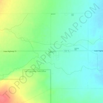
Name: Capulin topographic map, elevation, terrain.

Location: Capulin, Conejos County, Colorado, 81124, United States (37.26322 -106.13073 37.30322 -106.09073)

Average elevation: 2,387 m

Minimum elevation: 2,365 m

Maximum elevation: 2,431 m

Other topographic maps

Click on a map to view its topography, its elevation and its terrain.

Manassa

United States > Colorado > Conejos County

Manassa's elevation is 7,683 feet (2,342 m) above sea level. The land within Manassa city limits is entirely flat, with rolling hills nearby. Foothills and mountains (taller than 14,000 feet (4,300 m)) are farther in each direction, including the Sangre de Cristo Range to the east and the San Juan Mountains to…

Average elevation: 2,344 m

Antonito

United States > Colorado > Conejos County

Average elevation: 2,404 m

Sanford

United States > Colorado > Conejos County

Average elevation: 2,317 m

La Jara

United States > Colorado > Conejos County

Average elevation: 2,318 m

Romeo

United States > Colorado > Conejos County

Average elevation: 2,358 m

Gear up for your next adventure:

🧴Outdoor Sunscreen - High SPF protection for high-altitude UV exposure
🧼Travel Hand Sanitizer - Keep hands clean when water is scarce
🥾Approach Boots - Comfortable boots for hiking and climbing approaches
👖Convertible Hiking Pants - Zip-off legs to adapt to changing weather conditions
🧴Insect Repellent - Protect yourself from bugs during outdoor adventures

As an Amazon Associate, this site earns from qualifying purchases at no extra cost to you.