
Bastenaken topographic map
Interactive map
Click on the map to display elevation.
About this map
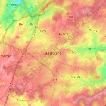
Name: Bastenaken topographic map, elevation, terrain.
Location: Bastenaken, Luxemburg, Wallonië, 6600, België (49.96231 5.67734 50.04231 5.75734)
Average elevation: 505 m
Minimum elevation: 413 m
Maximum elevation: 562 m
Other topographic maps
Click on a map to view its topography, its elevation and its terrain.
Foy
België > Luxemburg > Bastenaken > Bastenaken
Foy, Bastenaken, Luxemburg, Wallonië, België
Average elevation: 506 m