
Thank you for supporting this site ❤️
Make a donation
Make a donation
Gear up for your next adventure:
As an Amazon Associate, this site earns from qualifying purchases at no extra cost to you.
Ponibbiale topographic map
Click on the map to display elevation.
Thank you for supporting this site ❤️
Make a donation
Make a donation
Gear up for your next adventure:
As an Amazon Associate, this site earns from qualifying purchases at no extra cost to you.
About this map
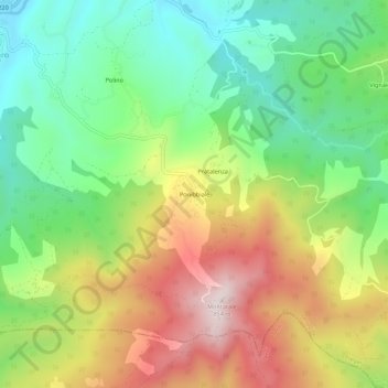
Name: Ponibbiale topographic map, elevation, terrain.
Location: Ponibbiale, Piegaro, Perugia, Umbria, 06066, Italia (42.93536 12.09451 42.97536 12.13451)
Average elevation: 513 m
Minimum elevation: 273 m
Maximum elevation: 850 m
Thank you for supporting this site ❤️
Make a donation
Make a donation
Gear up for your next adventure:
As an Amazon Associate, this site earns from qualifying purchases at no extra cost to you.