Geolocate

California topographic map

Click on the map to display elevation.

About this map

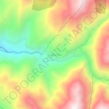
Name: California topographic map, elevation, terrain.

Location: California, Soto Norte, Santander, Colombia (7.32809 -72.96593 7.36809 -72.92593)

Average elevation: 2,309 m

Minimum elevation: 1,769 m

Maximum elevation: 2,849 m

Gear up for your next adventure:

🧥Ultralight Puffy Jacket - Maximum warmth that packs down to the size of an orange
🥾Mountain Trail Shoes - High-traction shoes for mountain trails
🔦LED Flashlight - Powerful and long-lasting flashlight for camping and emergencies
🧴Insect Repellent - Protect yourself from bugs during outdoor adventures
🧴Outdoor Sunscreen - High SPF protection for high-altitude UV exposure

As an Amazon Associate, this site earns from qualifying purchases at no extra cost to you.