Geolocate

Denver topographic map

Click on the map to display elevation.

About this map

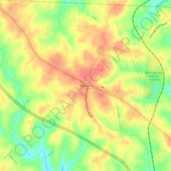
Name: Denver topographic map, elevation, terrain.

Location: Denver, Lincoln County, North Carolina, 28037, United States (35.51125 -81.04980 35.55125 -81.00980)

Average elevation: 259 m

Minimum elevation: 225 m

Maximum elevation: 282 m

Other topographic maps

Click on a map to view its topography, its elevation and its terrain.

Gear up for your next adventure:

🥤Collapsible Travel Cup - Saves space and weight in your mess kit
🥾Lightweight Hiking Boots - Boots for comfort and mobility on long hikes
🦟Insect Repellent - Keep mosquitoes and black flies away in wooded areas
🐕Hiking Dog Pack - Let your canine companion carry their own water and food
🚲Handlebar Phone Mount - View topographic-map.com live while cycling

As an Amazon Associate, this site earns from qualifying purchases at no extra cost to you.