
Make a donation
Gear up for your next adventure:
As an Amazon Associate, this site earns from qualifying purchases at no extra cost to you.
Obsidian Cliff topographic map
Click on the map to display elevation.
Make a donation
Gear up for your next adventure:
As an Amazon Associate, this site earns from qualifying purchases at no extra cost to you.
Obsidian Cliff
The cliff was formed from thick rhyolite lava flow that occurred about 180,000 years ago. The vertical columns are cooling fractures that formed as the thick lava flow cooled and crystallized. The Cliffs stands at an elevation of nearly 7,400 feet (2,300 m) above sea level and goes on for about half a mile. The cliffs also extend between 150 and 200 feet above Obsidian Creek. The flow consists of obsidian, a dark volcanic glass. The obsidian is most abundant at the base of the cliff and slowly tapers off to larger concentrations of pumice at the top. Obsidian from this site was first quarried here about 12,000 years ago. Early natives of North America placed a high value on the obsidian that came from this cliff as well as other similar obsidian deposits in the area because numerous tools could be fashioned from obsidian—most popularly, knives, spear/arrow tips, and other sharp-edged objects. In fact, obsidian from Obsidian Cliff was so sought after in early America (before the time of Columbus) that it was traded as far away as Ohio and Canada.
Make a donation
Gear up for your next adventure:
As an Amazon Associate, this site earns from qualifying purchases at no extra cost to you.
About this map
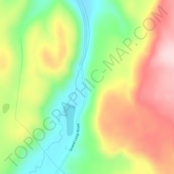
Name: Obsidian Cliff topographic map, elevation, terrain.
Location: Obsidian Cliff, Park County, Wyoming, United States (44.82081 -110.72762 44.82091 -110.72752)
Average elevation: 2,361 m
Minimum elevation: 2,238 m
Maximum elevation: 2,499 m
Make a donation
Gear up for your next adventure:
As an Amazon Associate, this site earns from qualifying purchases at no extra cost to you.