Geolocate

Moro topographic map

Click on the map to display elevation.

About this map

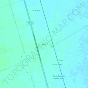
Name: Moro topographic map, elevation, terrain.

Location: Moro, Paucarcolla, Puno, Perú (-15.69449 -70.09045 -15.65449 -70.05045)

Average elevation: 3,817 m

Minimum elevation: 3,815 m

Maximum elevation: 3,820 m

Gear up for your next adventure:

📷Outdoor Action Camera - Capture high-elevation views and rugged adventures
💧Filtered Water Bottle - Safe drinking water on the go
Backpacking Tent - Lightweight tent for long-distance hiking trips
🥾Approach Boots - Comfortable boots for hiking and climbing approaches
💧Collapsible Water Bottle - Space-saving water bottle for outdoor activities

As an Amazon Associate, this site earns from qualifying purchases at no extra cost to you.