
Alterschrofen topographic map
Click on the map to display elevation.
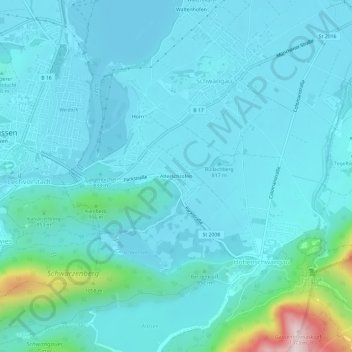
About this map
Name: Alterschrofen topographic map, elevation, terrain.
Average elevation: 843 m
Minimum elevation: 775 m
Maximum elevation: 1,339 m
Other topographic maps
Click on a map to view its topography, its elevation and its terrain.
Neuschwanstein Castle
Germany > Bavaria > Landkreis Ostallgäu > Hohenschwangau
The municipality of Schwangau lies at an elevation of 800 m (2,620 ft) at the southwest border of the German state of Bavaria. Its surroundings are characterised by the transition between the Alpine foothills in the south (toward the nearby Austrian border) and a hilly landscape in the north that appears flat…
Average elevation: 982 m