
Make a donation
Gear up for your next adventure:
As an Amazon Associate, this site earns from qualifying purchases at no extra cost to you.
Lappidot topographic map
Click on the map to display elevation.
Make a donation
Gear up for your next adventure:
As an Amazon Associate, this site earns from qualifying purchases at no extra cost to you.
About this map
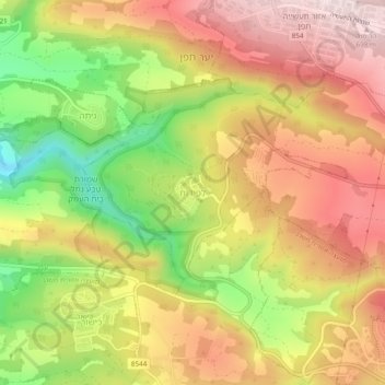
Name: Lappidot topographic map, elevation, terrain.
Average elevation: 498 m
Minimum elevation: 248 m
Maximum elevation: 698 m
Make a donation
Gear up for your next adventure:
As an Amazon Associate, this site earns from qualifying purchases at no extra cost to you.
Other topographic maps
Click on a map to view its topography, its elevation and its terrain.
Matat
Israel > North District > Maale Yosef Regional Council
Mattat's name is equivalent in gematria to 840, its altitude in metres. The high location and mountainous region provides the town with a relatively temperate climate. Summer temperatures rarely break 30 °C and humidity is low, and summer nights are even chilly. The winters are cold and wet, with an average…
Average elevation: 755 m
Make a donation
Gear up for your next adventure:
As an Amazon Associate, this site earns from qualifying purchases at no extra cost to you.