
Fin de Ville topographic map
Interactive map
Click on the map to display elevation.
About this map
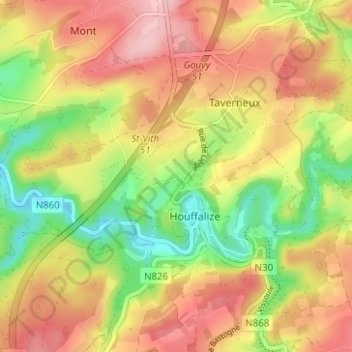
Name: Fin de Ville topographic map, elevation, terrain.
Average elevation: 403 m
Minimum elevation: 317 m
Maximum elevation: 480 m
Other topographic maps
Click on a map to view its topography, its elevation and its terrain.
Houffalize
Belgique > Luxembourg > Bastogne > Houffalize
Houffalize, Bastogne, Luxembourg, Wallonie, Belgique
Average elevation: 405 m