

Suita topographic map
Click on the map to display elevation.
Suita
Suita is located in northern Osaka Prefecture. The northern part of the city is occupied by the gently sloping Senri Hills, and the southern part is a plain made up of the Yodo River, Aui River, Kanzaki River, and sediments carried from rivers that originate in Senri Hills. The elevation of the city ranges from 1.5 meters to 115.7 meters above sea level. The city limits are 6.4 kilometers from east-to-west and 9.6 kilometers from north-to-south. In the past, the sea was right next to the city, and place names such as Toyotsu and Takahama still remain today. The Ani River runs through the southern edge of the city limits, and the Kanzaki River flows from east to west.
About this map
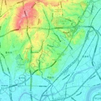
Name: Suita topographic map, elevation, terrain.
Location: Suita, Osaka Prefecture, Japan (34.74457 135.48680 34.83088 135.55565)
Average elevation: 33 m
Minimum elevation: -1 m
Maximum elevation: 123 m