
Thank you for supporting this site ❤️
Make a donation
Make a donation
Gear up for your next adventure:
As an Amazon Associate, this site earns from qualifying purchases at no extra cost to you.
Monterosso topographic map
Click on the map to display elevation.
Thank you for supporting this site ❤️
Make a donation
Make a donation
Gear up for your next adventure:
As an Amazon Associate, this site earns from qualifying purchases at no extra cost to you.
About this map
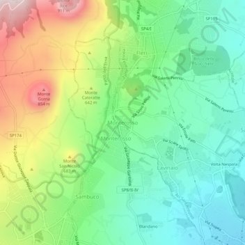
Name: Monterosso topographic map, elevation, terrain.
Location: Monterosso, Aci Sant'Antonio, Catania, Sicilia, 95025, Italia (37.62401 15.07390 37.66401 15.11390)
Average elevation: 540 m
Minimum elevation: 342 m
Maximum elevation: 915 m
Thank you for supporting this site ❤️
Make a donation
Make a donation
Gear up for your next adventure:
As an Amazon Associate, this site earns from qualifying purchases at no extra cost to you.