Geolocate

Morges topographic map

Click on the map to display elevation.

About this map
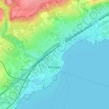
Name: Morges topographic map, elevation, terrain.

Location: Morges, District de Morges, Vaud, 1110, Switzerland (46.45625 6.47651 46.52375 6.52955)

Average elevation: 386 m

Minimum elevation: 369 m

Maximum elevation: 519 m

Gear up for your next adventure:

🎒Fully Waterproof Backpack - Total protection for photography gear and electronics
👟Leg Gaiters - Keep debris, mud, and snow out of your boots
🥾Trekking Boots - Durable boots for long-distance trekking
🗺️Topographic Maps - Detailed maps to explore trails, mountains, and wilderness areas
🧤Rechargeable Heated Gloves - Extreme warmth for Canadian winter expeditions

As an Amazon Associate, this site earns from qualifying purchases at no extra cost to you.