Geolocate

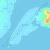
Tolosa topographic map

Click on the map to display elevation.

About this map

Name: Tolosa topographic map, elevation, terrain.

Location: Tolosa, Zamboanga City, Zamboanga Peninsula, 7000, Philippines (7.01234 122.10779 7.05234 122.14779)

Average elevation: 227 m

Minimum elevation: 76 m

Maximum elevation: 366 m

Other topographic maps

Click on a map to view its topography, its elevation and its terrain.

Sacol Island

Philippines > Zamboanga City

Average elevation: 6 m

Vitali River

Philippines > Zamboanga City > Mangusu

Average elevation: 27 m

Sinunug Island

Philippines > Zamboanga City

Average elevation: 0 m

Plaza Pershing

Philippines > Zamboanga City

Average elevation: 4 m

Gear up for your next adventure:

🛶Canoe Life Vest - Safety vest for water sports
🧥Ultralight Puffy Jacket - Maximum warmth that packs down to the size of an orange
🧭GPS Outdoor Watch - Smart watch for navigation and fitness tracking in nature
🕯️Camping Lantern - Illuminates your entire campsite with high-efficiency LEDs
🎒Backpack Rain Cover - External shield to keep your entire pack dry

As an Amazon Associate, this site earns from qualifying purchases at no extra cost to you.