Geolocate

Siddhalek topographic map

Click on the map to display elevation.

About this map

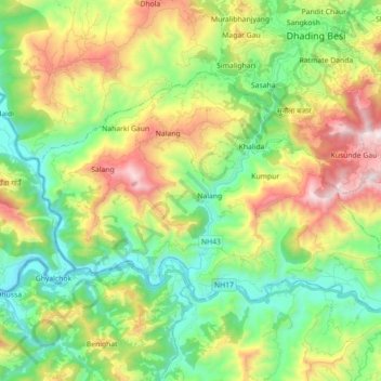
Name: Siddhalek topographic map, elevation, terrain.

Location: Siddhalek, Dhading, Bagmati Pradesh, Nepal (27.79742 84.76542 27.89617 84.94355)

Average elevation: 765 m

Minimum elevation: 311 m

Maximum elevation: 1,586 m

Gear up for your next adventure:

🧦Merino Wool Socks - Moisture-wicking comfort for long-distance hiking
🥾Mountain Hiking Boots - High-traction boots for rocky terrain
🥾Hiking Boots - Sturdy boots providing ankle support and traction on rugged trails
🛶Kayak Dry Bag - Waterproof storage for kayaking adventures
👟Leg Gaiters - Keep debris, mud, and snow out of your boots

As an Amazon Associate, this site earns from qualifying purchases at no extra cost to you.