
Capitan Loreto topographic map
Interactive map
Click on the map to display elevation.
About this map
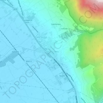
Name: Capitan Loreto topographic map, elevation, terrain.
Location: Capitan Loreto, Spello, Perugia, Umbría, 06038, Italia (42.99880 12.62783 43.03880 12.66783)
Average elevation: 307 m
Minimum elevation: 185 m
Maximum elevation: 1,040 m