
Thank you for supporting this site ❤️
Make a donation
Make a donation
Gear up for your next adventure:
As an Amazon Associate, this site earns from qualifying purchases at no extra cost to you.
Cutivireni topographic map
Click on the map to display elevation.
Thank you for supporting this site ❤️
Make a donation
Make a donation
Gear up for your next adventure:
As an Amazon Associate, this site earns from qualifying purchases at no extra cost to you.
About this map
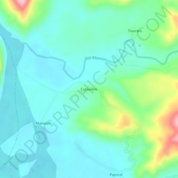
Name: Cutivireni topographic map, elevation, terrain.
Location: Cutivireni, Río Tambo, Satipo, Junín, Perú (-11.89364 -73.92819 -11.85364 -73.88819)
Average elevation: 424 m
Minimum elevation: 385 m
Maximum elevation: 556 m
Thank you for supporting this site ❤️
Make a donation
Make a donation
Gear up for your next adventure:
As an Amazon Associate, this site earns from qualifying purchases at no extra cost to you.