
Thank you for supporting this site ❤️
Make a donation
Make a donation
Gear up for your next adventure:
As an Amazon Associate, this site earns from qualifying purchases at no extra cost to you.
Humde topographic map
Click on the map to display elevation.
Thank you for supporting this site ❤️
Make a donation
Make a donation
Gear up for your next adventure:
As an Amazon Associate, this site earns from qualifying purchases at no extra cost to you.
About this map
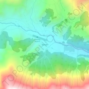
Name: Humde topographic map, elevation, terrain.
Location: Humde, Manang, Neshyang, Manang, Gandaki Pradesh, Nepal (28.61822 84.07048 28.65822 84.11048)
Average elevation: 3,692 m
Minimum elevation: 3,304 m
Maximum elevation: 4,498 m
Thank you for supporting this site ❤️
Make a donation
Make a donation
Gear up for your next adventure:
As an Amazon Associate, this site earns from qualifying purchases at no extra cost to you.