
Make a donation
Gear up for your next adventure:
As an Amazon Associate, this site earns from qualifying purchases at no extra cost to you.
Tromm topographic map
Click on the map to display elevation.
Make a donation
Gear up for your next adventure:
As an Amazon Associate, this site earns from qualifying purchases at no extra cost to you.
Tromm
Die Tromm ist ein markanter Bergrücken im Odenwald im Südosten des Kreises Bergstraße in Südhessen, der sich östlich des Weschnitztales (mit den Dörfern Mörlenbach und Rimbach) rund 400 m über das Tal erhebt und an seinem höchsten Punkt eine Höhe von 576,8 m ü. NHN erreicht.
Make a donation
Gear up for your next adventure:
As an Amazon Associate, this site earns from qualifying purchases at no extra cost to you.
About this map
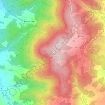
Name: Tromm topographic map, elevation, terrain.
Average elevation: 424 m
Minimum elevation: 232 m
Maximum elevation: 575 m
Make a donation
Gear up for your next adventure:
As an Amazon Associate, this site earns from qualifying purchases at no extra cost to you.