
Make a donation
Gear up for your next adventure:
As an Amazon Associate, this site earns from qualifying purchases at no extra cost to you.
Puente del Inca topographic map
Click on the map to display elevation.
Make a donation
Gear up for your next adventure:
As an Amazon Associate, this site earns from qualifying purchases at no extra cost to you.
Puente del Inca
Situated at 2,744 m (9,003 ft) above sea level, Puente del Inca has a warm-summer mediterranean continental climate (Dsb, according to the Köppen climate classification), as at least 4 months see an average temperature above 10 °C (50 °F) and at least one month sees an average temperature below 0 °C (32 °F), having dry, moderate summers and snowy winters. This (continental) type of climate is extremely rare in both South America and the Southern Hemisphere at large, due to the scarcity of large landmasses in the extratropical southern latitudes. Puente del Inca achieves it due to its relatively large distance from its nearest ocean—146 kilometres (91 mi); close enough to bring moisture to avoid having a cold semi-arid climate like the nearby Arid Diagonal but distant enough to increase the seasonal temperature variation—its leeward position in the Andes, and its high elevation reducing temperatures to well below that of the surrounding area. Nevertheless, its vegetation (notably lacking the typical hemiboreal or subalpine forests) is far more consistent with a cold semi-arid climate (BSk, according to Köppen).
Make a donation
Gear up for your next adventure:
As an Amazon Associate, this site earns from qualifying purchases at no extra cost to you.
About this map
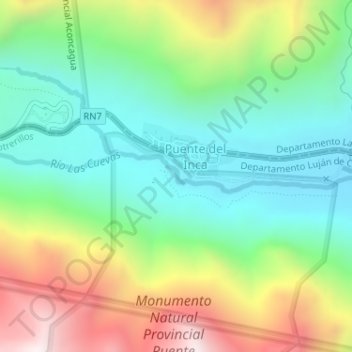
Name: Puente del Inca topographic map, elevation, terrain.
Average elevation: 3,006 m
Minimum elevation: 2,680 m
Maximum elevation: 3,599 m
Make a donation
Gear up for your next adventure:
As an Amazon Associate, this site earns from qualifying purchases at no extra cost to you.