
Thank you for supporting this site ❤️
Make a donation
Make a donation
Gear up for your next adventure:
As an Amazon Associate, this site earns from qualifying purchases at no extra cost to you.
Cerna topographic map
Click on the map to display elevation.
Thank you for supporting this site ❤️
Make a donation
Make a donation
Gear up for your next adventure:
As an Amazon Associate, this site earns from qualifying purchases at no extra cost to you.
About this map
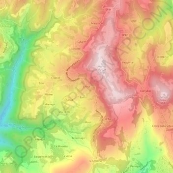
Name: Cerna topographic map, elevation, terrain.
Location: Cerna, Sant'Anna d'Alfaedo, Verona, Veneto, 37020, Italia (45.57840 10.91793 45.61840 10.95793)
Average elevation: 680 m
Minimum elevation: 334 m
Maximum elevation: 925 m
Thank you for supporting this site ❤️
Make a donation
Make a donation
Gear up for your next adventure:
As an Amazon Associate, this site earns from qualifying purchases at no extra cost to you.