
Thank you for supporting this site ❤️
Make a donation
Make a donation
Gear up for your next adventure:
As an Amazon Associate, this site earns from qualifying purchases at no extra cost to you.
Valle topographic map
Click on the map to display elevation.
Thank you for supporting this site ❤️
Make a donation
Make a donation
Gear up for your next adventure:
As an Amazon Associate, this site earns from qualifying purchases at no extra cost to you.
About this map
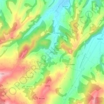
Name: Valle topographic map, elevation, terrain.
Location: Valle, Gropparello, Piacenza, Emilia-Romagna, 29025, Italia (44.81914 9.72088 44.85914 9.76088)
Average elevation: 324 m
Minimum elevation: 200 m
Maximum elevation: 479 m
Thank you for supporting this site ❤️
Make a donation
Make a donation
Gear up for your next adventure:
As an Amazon Associate, this site earns from qualifying purchases at no extra cost to you.