Geolocate

Larchamp topographic map

Click on the map to display elevation.

About this map
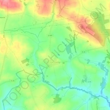
Name: Larchamp topographic map, elevation, terrain.

Location: Larchamp, Tinchebray-Bocage, Argentan, Orne, Normandie, France métropolitaine, 61800, France (48.68300 -0.70982 48.71182 -0.65224)

Average elevation: 254 m

Minimum elevation: 210 m

Maximum elevation: 313 m

Other topographic maps

Click on a map to view its topography, its elevation and its terrain.

Le Béchet

France > Normandie > Orne > Tinchebray-Bocage > Beauchêne

Average elevation: 233 m

Le Rocher

France > Normandie > Orne > Tinchebray-Bocage > Yvrandes > Le Rocher

Average elevation: 262 m

Beaulieu

France > Normandie > Orne > Tinchebray-Bocage > Tinchebray

Average elevation: 229 m

Gear up for your next adventure:

🧥Waterproof Hiking Jacket - Protect yourself from rain and wind while hiking
👟Leg Gaiters - Keep debris, mud, and snow out of your boots
🚑Survival Whistle - Signal for help across long distances in mountains
☕Camping Coffee Maker - Brew fresh coffee anywhere on the topographic map
🧶550 Survival Paracord - Versatile utility cord for emergency repairs and rigging

As an Amazon Associate, this site earns from qualifying purchases at no extra cost to you.