Geolocate

Huaran topographic map

Click on the map to display elevation.

About this map

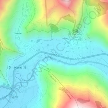
Name: Huaran topographic map, elevation, terrain.

Location: Huaran, Arin, Calca, Cusco, 08471, Perú (-13.33081 -72.03905 -13.29081 -71.99905)

Average elevation: 3,191 m

Minimum elevation: 2,874 m

Maximum elevation: 4,007 m

Gear up for your next adventure:

💧Reusable Water Bottle - Durable water bottles for hydration on trails
💡Portable Camping Lamp - Rechargeable lamp for campsite lighting
🥾Trail Hiking Boots - Supportive boots for rough trails
🥾Trekking Poles - Adjustable trekking poles to reduce knee stress and improve stability
🔦UV Flashlight - Detect minerals or specific insects in the dark

As an Amazon Associate, this site earns from qualifying purchases at no extra cost to you.