
Thank you for supporting this site ❤️
Make a donation
Make a donation
Gear up for your next adventure:
As an Amazon Associate, this site earns from qualifying purchases at no extra cost to you.
Atalaia topographic map
Click on the map to display elevation.
Thank you for supporting this site ❤️
Make a donation
Make a donation
Gear up for your next adventure:
As an Amazon Associate, this site earns from qualifying purchases at no extra cost to you.
About this map
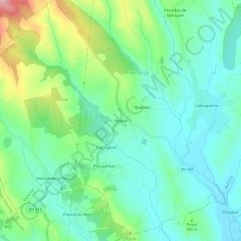
Name: Atalaia topographic map, elevation, terrain.
Location: Atalaia, Ventosa, Alenquer, Lisboa, 2580-403, Portugal (39.09705 -9.11307 39.13705 -9.07307)
Average elevation: 125 m
Minimum elevation: 69 m
Maximum elevation: 269 m
Thank you for supporting this site ❤️
Make a donation
Make a donation
Gear up for your next adventure:
As an Amazon Associate, this site earns from qualifying purchases at no extra cost to you.