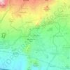
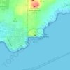
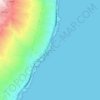
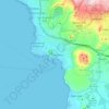
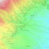
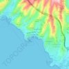
Valverde topographic map
Click on the map to display elevation.
Valverde
Pastureland and smallholdings dominate the central plateau area with pine and cloud forest at progressively higher elevations. The coastal areas and lower slopes are arid and mainly left to unimproved scrub and sparse grassland. Volcanism is prominent, with several cinder cones and areas of lava flow to be seen.
About this map

Name: Valverde topographic map, elevation, terrain.
Location: Valverde, Santa Cruz de Tenerife, Canary Islands, Spain (27.69193 -18.02497 27.84985 -17.88281)
Average elevation: 274 m
Minimum elevation: 0 m
Maximum elevation: 1,361 m
Other topographic maps
Click on a map to view its topography, its elevation and its terrain.


Teide
Spain > Canary Islands > La Orotava
Teide, or Mount Teide, (Spanish: El Teide, Pico del Teide, pronounced [ˈpiko ðel ˈtejðe], "Peak of Teide") is a volcano on Tenerife in the Canary Islands, Spain. Its summit (at 3,715 m (12,188 ft)) is the highest point in Spain and the highest point above sea level in the islands of the Atlantic. If…
Average elevation: 3,200 m



Masca
Spain > Canary Islands > Buenavista del Norte
Masca is a small mountain village on the island of Tenerife. It was originally a Guanche settlement before the Spanish conquest in 1496. The village is now home to around 90 inhabitants. The village lies at an altitude of 650 m in the Macizo de Teno mountains, which extend up to the northwesternmost point of…
Average elevation: 769 m



La Cruz Chica
Spain > Canary Islands > San Cristóbal de La Laguna > El Ortigal
Average elevation: 606 m

Parque de la Puerta de Tierra
Spain > Canary Islands > San Juan del Reparo (La Culata) > San Pedro de Daute
Average elevation: 182 m