Geolocate

Ravenna topographic map

Click on the map to display elevation.

About this map

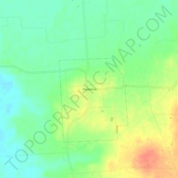
Name: Ravenna topographic map, elevation, terrain.

Location: Ravenna, Fannin County, Texas, 75476, United States (33.65288 -96.26165 33.69288 -96.22165)

Average elevation: 177 m

Minimum elevation: 158 m

Maximum elevation: 204 m

Gear up for your next adventure:

🧦Hiking Socks - Moisture-wicking and comfortable socks for long hikes
🧭GPS Tracker - Track your location in remote areas safely
Lightweight Camping Tent - Portable shelter optimized for Canadian backcountry camping
🥾Trail Running Shoes - Lightweight and durable shoes for trail running
🏃Hydration Running Vest - Carry water and maps close to your body for speed

As an Amazon Associate, this site earns from qualifying purchases at no extra cost to you.