
Thank you for supporting this site ❤️
Make a donation
Make a donation
Gear up for your next adventure:
As an Amazon Associate, this site earns from qualifying purchases at no extra cost to you.
Tubod topographic map
Click on the map to display elevation.
Thank you for supporting this site ❤️
Make a donation
Make a donation
Gear up for your next adventure:
As an Amazon Associate, this site earns from qualifying purchases at no extra cost to you.
About this map
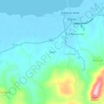
Name: Tubod topographic map, elevation, terrain.
Location: Tubod, Candajec, Bohol, Central Visayas, 3629, Philippines (9.93000 123.99667 9.97000 124.03667)
Average elevation: 49 m
Minimum elevation: -8 m
Maximum elevation: 285 m
Thank you for supporting this site ❤️
Make a donation
Make a donation
Gear up for your next adventure:
As an Amazon Associate, this site earns from qualifying purchases at no extra cost to you.