
Rivière du Portage topographic map
Interactive map
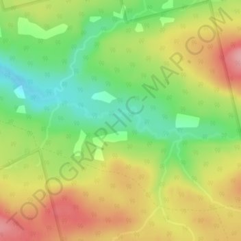
Click on the map to display elevation.
About this map
Name: Rivière du Portage topographic map, elevation, terrain.
Average elevation: 395 m
Minimum elevation: 333 m
Maximum elevation: 461 m
Other topographic maps
Click on a map to view its topography, its elevation and its terrain.
ZEC Jaro
Canada > Québec > Saint-Théophile
ZEC Jaro, Chemin du Ruisseau-Croche, Saint-Théophile, Beauce-Sartigan, Chaudière-Appalaches, Québec, Canada
Average elevation: 484 m