Geolocate

Balatan topographic map

Click on the map to display elevation.

About this map

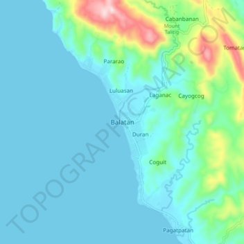
Name: Balatan topographic map, elevation, terrain.

Location: Balatan, Camarines Sur, Bicol Region, 4436, Philippines (13.27690 123.20029 13.35690 123.28029)

Average elevation: 78 m

Minimum elevation: 0 m

Maximum elevation: 402 m

Gear up for your next adventure:

🧤Insulated Winter Gloves - Heavy-duty protection for sub-zero Canadian adventures
🥾Lightweight Hiking Boots - Boots for comfort and mobility on long hikes
👟Leg Gaiters - Keep debris, mud, and snow out of your boots
🥫Freeze-Dried Meals - Lightweight, high-calorie nutrition for multi-day treks
🛶Canoe Life Vest - Safety vest for water sports

As an Amazon Associate, this site earns from qualifying purchases at no extra cost to you.