
Thank you for supporting this site ❤️
Make a donation
Make a donation
Gear up for your next adventure:
As an Amazon Associate, this site earns from qualifying purchases at no extra cost to you.
Fronteriza topographic map
Click on the map to display elevation.
Thank you for supporting this site ❤️
Make a donation
Make a donation
Gear up for your next adventure:
As an Amazon Associate, this site earns from qualifying purchases at no extra cost to you.
About this map
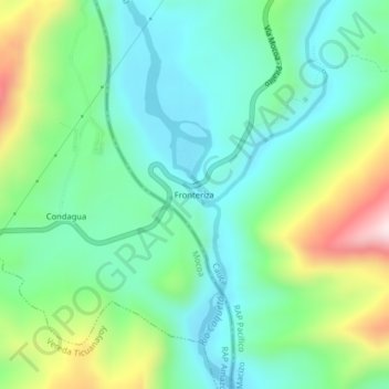
Name: Fronteriza topographic map, elevation, terrain.
Location: Fronteriza, Santa Rosa, Macizo, Cauca, RAP Pacífico, Colombia (1.25396 -76.59470 1.29396 -76.55470)
Average elevation: 666 m
Minimum elevation: 514 m
Maximum elevation: 1,040 m
Thank you for supporting this site ❤️
Make a donation
Make a donation
Gear up for your next adventure:
As an Amazon Associate, this site earns from qualifying purchases at no extra cost to you.