
Cradley topographic map
Interactive map
Click on the map to display elevation.
About this map
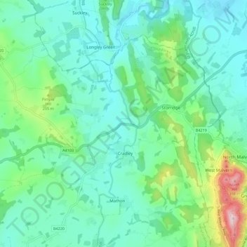
Name: Cradley topographic map, elevation, terrain.
Location: Cradley, Herefordshire, England, United Kingdom (52.10637 -2.45479 52.15510 -2.34461)
Average elevation: 127 m
Minimum elevation: 45 m
Maximum elevation: 423 m
Other topographic maps
Click on a map to view its topography, its elevation and its terrain.
Wigmore
United Kingdom > England > Herefordshire
Wigmore, Herefordshire, England, United Kingdom
Average elevation: 167 m
Hereford
United Kingdom > England > Herefordshire
Hereford, Herefordshire, England, United Kingdom
Average elevation: 68 m
Merryhill
United Kingdom > England > Herefordshire > Brinsop
Merryhill, Brinsop, Herefordshire, England, HR4 7HH, United Kingdom
Average elevation: 139 m