
Ain Bida topographic map
Interactive map
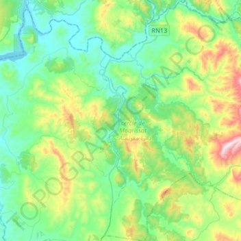
Click on the map to display elevation.
About this map
Name: Ain Bida topographic map, elevation, terrain.
Average elevation: 284 m
Minimum elevation: 54 m
Maximum elevation: 954 m
Other topographic maps
Click on a map to view its topography, its elevation and its terrain.
Fejj Demna
Maroc > cercle de Moqrissat > Asjen
Fejj Demna, Asjen, Caïdat de Brikcha, cercle de Moqrissat, Province de Ouezzane, Tanger-Tétouan-Al Hoceïma, Maroc
Average elevation: 263 m
Ghwiba
Maroc > cercle de Moqrissat > Asjen
Ghwiba, Asjen, Caïdat de Brikcha, cercle de Moqrissat, Province de Ouezzane, Tanger-Tétouan-Al Hoceïma, 16203, Maroc
Average elevation: 326 m
Moqrisset
Moqrisset, Caïdat de Moqrissat, cercle de Moqrissat, Province de Ouezzane, Tanger-Tétouan-Al Hoceïma, 91152, Maroc
Average elevation: 514 m