
Seegehalli topographic map
Interactive map
Click on the map to display elevation.
About this map
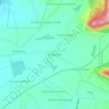
Name: Seegehalli topographic map, elevation, terrain.
Average elevation: 959 m
Minimum elevation: 903 m
Maximum elevation: 1,179 m
Other topographic maps
Click on a map to view its topography, its elevation and its terrain.
Kasavanahalli
India > Karnataka > Doddaballapura taluk
Kasavanahalli, Doddaballapura taluk, Bangalore Rural, Karnataka, 562163, India
Average elevation: 895 m
Doddaballapura
India > Karnataka > Doddaballapura taluk
Doddaballapura, Doddaballapura taluk, Bengaluru Rural District, Karnataka, 561203, India
Average elevation: 899 m