Geolocate

Danau topographic map

Click on the map to display elevation.

About this map

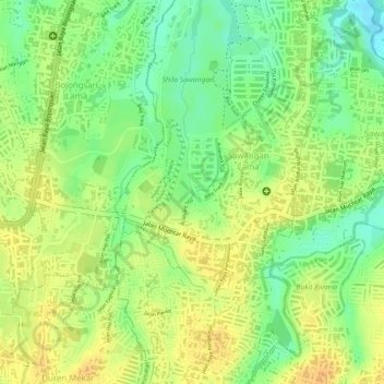
Name: Danau topographic map, elevation, terrain.

Location: Danau, Sawangan Lama, Sawangan, Bogor, West Java, Indonesia (-6.40444 106.75283 -6.40378 106.75317)

Average elevation: 88 m

Minimum elevation: 67 m

Maximum elevation: 102 m

Gear up for your next adventure:

🧢Outdoor Cap - Protective cap for sun and rain during hikes
🚲Handlebar Phone Mount - View topographic-map.com live while cycling
🧊Insulated Water Bottle - Keeps drinks cold in summer and prevents freezing in winter
🦌Outdoor Trail Camera - Monitor wildlife activity near your favorite spots
💡LED Headlamp - Hands-free illumination for night hiking and camping

As an Amazon Associate, this site earns from qualifying purchases at no extra cost to you.