
Thank you for supporting this site ❤️
Make a donation
Make a donation
Gear up for your next adventure:
As an Amazon Associate, this site earns from qualifying purchases at no extra cost to you.
Holcombe topographic map
Click on the map to display elevation.
Thank you for supporting this site ❤️
Make a donation
Make a donation
Gear up for your next adventure:
As an Amazon Associate, this site earns from qualifying purchases at no extra cost to you.
About this map
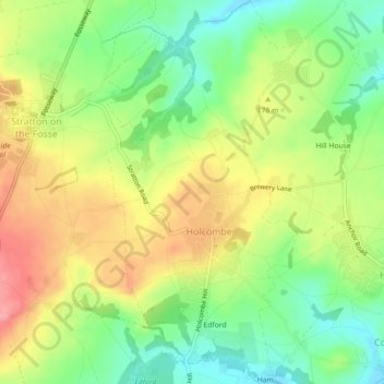
Name: Holcombe topographic map, elevation, terrain.
Location: Holcombe, Mendip District, Somerset, England, United Kingdom (51.23522 -2.48469 51.26324 -2.46205)
Average elevation: 166 m
Minimum elevation: 121 m
Maximum elevation: 217 m
Thank you for supporting this site ❤️
Make a donation
Make a donation
Gear up for your next adventure:
As an Amazon Associate, this site earns from qualifying purchases at no extra cost to you.