Geolocate

Dharwad topographic map

Click on the map to display elevation.

About this map

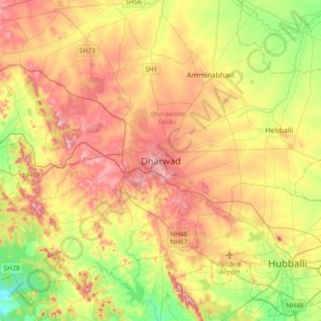
Name: Dharwad topographic map, elevation, terrain.

Location: Dharwad, Dharawada taluku, Dharwad, Karnataka, 580001, India (15.29405 74.84665 15.61405 75.16665)

Average elevation: 656 m

Minimum elevation: 543 m

Maximum elevation: 778 m

Gear up for your next adventure:

🦌Outdoor Trail Camera - Monitor wildlife activity near your favorite spots
🦟Insect Repellent - Keep mosquitoes and black flies away in wooded areas
🧥Fleece Jacket - Warm and lightweight jacket for layering
🧶550 Survival Paracord - Versatile utility cord for emergency repairs and rigging
🌬️Windproof Camp Stove - Efficient cooking even on exposed mountain peaks

As an Amazon Associate, this site earns from qualifying purchases at no extra cost to you.