
Lakeville topographic map
Interactive map
Click on the map to display elevation.
About this map
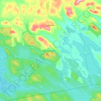
Name: Lakeville topographic map, elevation, terrain.
Location: Lakeville, Penobscot County, Maine, United States (45.23718 -68.21280 45.36842 -68.00258)
Average elevation: 132 m
Minimum elevation: 78 m
Maximum elevation: 316 m
Other topographic maps
Click on a map to view its topography, its elevation and its terrain.
Spring Island
United States > Maine > Penobscot County > T4 Indian Purchase Township
Average elevation: 151 m