Geolocate

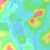
Goodnow Flow topographic map

Click on the map to display elevation.

About this map

Name: Goodnow Flow topographic map, elevation, terrain.

Location: Goodnow Flow, Town of Newcomb, Essex County, New York, United States (43.91214 -74.24293 43.92152 -74.18606)

Average elevation: 553 m

Minimum elevation: 486 m

Maximum elevation: 756 m

Other topographic maps

Click on a map to view its topography, its elevation and its terrain.
Tahawus

United States > New York > Essex County > Town of Newcomb

Average elevation: 561 m

Gear up for your next adventure:

🦶Anti-Blister Balm - Prevents friction and hotspots during long ascents
🥾Trail Hiking Boots - Supportive boots for rough trails
🧰Survival Kit - Essential gear for emergencies in the wilderness
🕶️Polarized Sunglasses - Protect your eyes with durable polarized lenses
🧥Waterproof Hiking Jacket - Protect yourself from rain and wind while hiking

As an Amazon Associate, this site earns from qualifying purchases at no extra cost to you.