Geolocate

Socavão topographic map

Click on the map to display elevation.

About this map
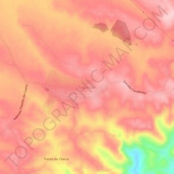
Name: Socavão topographic map, elevation, terrain.

Location: Socavão, Castro, Região Geográfica Imediata de Ponta Grossa, Região Geográfica Intermediária de Ponta Grossa, Paraná, Região Sul, Brasil (-24.79242 -49.71624 -24.75242 -49.67624)

Average elevation: 1,011 m

Minimum elevation: 869 m

Maximum elevation: 1,058 m

Other topographic maps

Click on a map to view its topography, its elevation and its terrain.

Rio Socavão

Brasil > Paraná > Castro

Average elevation: 750 m

Parque Lacustre Fase II

Brasil > Paraná > Castro

Average elevation: 1,001 m

Mirante da Serra

Brasil > Paraná > Castro

Average elevation: 1,010 m

Gear up for your next adventure:

🥾Durable Hiking Shoes - Long-lasting shoes for frequent hiking
🧊Insulated Water Bottle - Keeps drinks cold in summer and prevents freezing in winter
🥾Hiking Shorts - Breathable shorts suitable for summer hikes
❄️Traction Ice Cleats - Slip-on spikes for icy trails and winter hiking
🧦Thermal Socks - Warm socks for winter hiking or camping

As an Amazon Associate, this site earns from qualifying purchases at no extra cost to you.