Geolocate

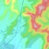
Wingina topographic map

Click on the map to display elevation.

About this map

Name: Wingina topographic map, elevation, terrain.

Location: Wingina, Nelson County, Virginia, 24599, United States (37.61987 -78.74390 37.65987 -78.70390)

Average elevation: 148 m

Minimum elevation: 98 m

Maximum elevation: 219 m

Other topographic maps

Click on a map to view its topography, its elevation and its terrain.

Afton

United States > Virginia > Nelson County > Afton

Average elevation: 352 m

Nellysford

United States > Virginia > Nelson County > Nellysford

Average elevation: 397 m

Lovingston

United States > Virginia > Nelson County > Lovingston

Average elevation: 316 m

Schuyler

United States > Virginia > Nelson County

Average elevation: 153 m

Schuyler

United States > Virginia > Nelson County

Average elevation: 153 m

Afton

United States > Virginia > Nelson County > Afton

Average elevation: 352 m

Gear up for your next adventure:

🔥Camping Stove - Portable stoves to cook outdoors with ease
🧭GPS Handheld Device - Reliable GPS navigation for outdoor adventures
💧Filtered Water Bottle - Safe drinking water on the go
💡Solar Camping Lamp - Eco-friendly lighting for campsites
🪜Heavy Duty Carabiners - Multi-use clips for securing gear to your backpack

As an Amazon Associate, this site earns from qualifying purchases at no extra cost to you.