Geolocate

Varkala topographic map

Click on the map to display elevation.

About this map
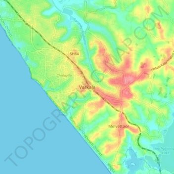
Name: Varkala topographic map, elevation, terrain.

Location: Varkala, Thiruvananthapuram, Kerala, 695145, India (8.69404 76.68529 8.77404 76.76529)

Average elevation: 23 m

Minimum elevation: 0 m

Maximum elevation: 78 m

Other topographic maps

Click on a map to view its topography, its elevation and its terrain.

Varkkala

India > Kerala > Varkala > Varkala

Average elevation: 29 m

Gear up for your next adventure:

🧊Portable Cooler - Keep food and drinks cold during outdoor adventures
⛺Camping Groundsheet - Protect your tent from moisture and dirt
🥾Light Hiking Boots - Lightweight and comfortable boots for day hikes
🧦Hiking Socks - Moisture-wicking and comfortable socks for long hikes
🧊Insulated Water Bottle - Keeps drinks cold in summer and prevents freezing in winter

As an Amazon Associate, this site earns from qualifying purchases at no extra cost to you.