
Thank you for supporting this site ❤️
Make a donation
Make a donation
Gear up for your next adventure:
As an Amazon Associate, this site earns from qualifying purchases at no extra cost to you.
Narayangaon topographic map
Click on the map to display elevation.
Thank you for supporting this site ❤️
Make a donation
Make a donation
Gear up for your next adventure:
As an Amazon Associate, this site earns from qualifying purchases at no extra cost to you.
About this map
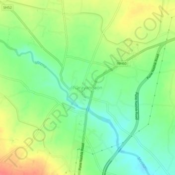
Name: Narayangaon topographic map, elevation, terrain.
Location: Narayangaon, Junnar, Pune District, Maharashtra, 410504, India (19.10029 73.95329 19.14029 73.99329)
Average elevation: 664 m
Minimum elevation: 639 m
Maximum elevation: 698 m
Thank you for supporting this site ❤️
Make a donation
Make a donation
Gear up for your next adventure:
As an Amazon Associate, this site earns from qualifying purchases at no extra cost to you.