Geolocate

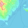
Beacon Rock topographic map

Click on the map to display elevation.

About this map

Name: Beacon Rock topographic map, elevation, terrain.

Location: Beacon Rock, South Sinai, Egypt (27.69382 34.11747 27.71382 34.13747)

Average elevation: 0 m

Minimum elevation: 0 m

Maximum elevation: 0 m

Other topographic maps

Click on a map to view its topography, its elevation and its terrain.
Ras Sudr

Egypt > South Sinai

Average elevation: 17 m

Ras Muhammad National Park

Egypt > South Sinai

Average elevation: 112 m

Abu Galum Protectorate

Egypt > South Sinai

Average elevation: 632 m

Ras Sudr

Egypt > South Sinai

Average elevation: 17 m

Al Tour City

Egypt > South Sinai

Average elevation: 50 m

Wadi Khuraytah

Egypt > South Sinai > Saint Catherine

Average elevation: 1,323 m

Gear up for your next adventure:

⛺Lightweight Backpacking Tent - Compact tent for efficient hiking trips
🔭Outdoor Binoculars - Lightweight binoculars for birdwatching and hiking
🚑Survival Whistle - Signal for help across long distances in mountains
💧Hydration Pack - Hands-free hydration system for long hikes
🛌Insulated Sleeping Pad - Critical thermal barrier between you and the cold ground

As an Amazon Associate, this site earns from qualifying purchases at no extra cost to you.