Geolocate

Una topographic map

Click on the map to display elevation.

About this map

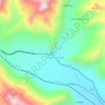
Name: Una topographic map, elevation, terrain.

Location: Una, Machu Huasi, Santa Rosa, Melgar, Puno, Perú (-14.51540 -70.96117 -14.47540 -70.92117)

Average elevation: 4,365 m

Minimum elevation: 4,110 m

Maximum elevation: 4,899 m

Gear up for your next adventure:

🩹Moleskin Blister Pads - Direct protection for painful foot pressure points
Camping Tent - Weather-resistant tents suitable for 2 to 6 people
🧢Sun Hat - Wide-brim hat for sun protection
🧭Orienteering Kit - Tools for map reading and navigation in the wild
🥾Mountain Hiking Boots - High-traction boots for rocky terrain

As an Amazon Associate, this site earns from qualifying purchases at no extra cost to you.