Geolocate

Altdöbern topographic map

Click on the map to display elevation.

About this map
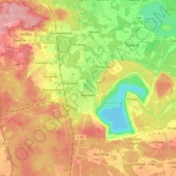
Name: Altdöbern topographic map, elevation, terrain.

Location: Altdöbern, Oberspreewald-Lausitz - Górne Błota-Łužyca, Brandenburg, Duitsland (51.61071 13.94128 51.70031 14.12904)

Average elevation: 102 m

Minimum elevation: 40 m

Maximum elevation: 159 m

Other topographic maps

Click on a map to view its topography, its elevation and its terrain.

Gear up for your next adventure:

🔋Lithium AA Batteries - Long-lasting power that performs in extreme cold
🥾Trail Hiking Socks - Comfortable socks to prevent blisters and fatigue
🔦LED Headlamp - Hands-free lighting for early morning starts or late finishes
🧦Outdoor Socks - Durable socks designed for hiking and outdoor sports
🛏️Sleeping Bag - Warm and compact sleeping bags for outdoor camping

As an Amazon Associate, this site earns from qualifying purchases at no extra cost to you.