Geolocate

Folquer topographic map

Click on the map to display elevation.

About this map

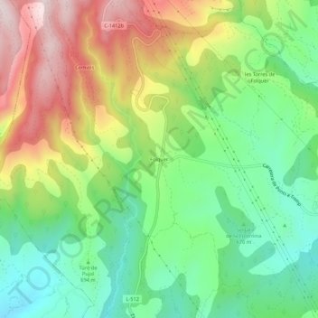
Name: Folquer topographic map, elevation, terrain.

Location: Folquer, Artesa de Segre, Noguera, Cataluña, 25738, España (41.99409 1.09355 42.03409 1.13355)

Average elevation: 741 m

Minimum elevation: 536 m

Maximum elevation: 1,043 m

Gear up for your next adventure:

🧳Compression Sacks - Maximize space in your backpack by shrinking gear
🧦Thermal Socks - Warm socks for winter hiking or camping
🧦Crew Hiking Socks - Comfortable socks for long-distance hikes
💡Solar Camping Lamp - Eco-friendly lighting for campsites
🐕Hiking Dog Pack - Let your canine companion carry their own water and food

As an Amazon Associate, this site earns from qualifying purchases at no extra cost to you.