Geolocate

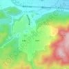
Koto topographic map

Click on the map to display elevation.

Koto

Kōtō occupies a position on the waterfront of Tokyo Bay sandwiched between the wards of Chūō and Edogawa. To the North, its inland boundary is with the Sumida special ward. Much of the land is reclaimed, The northern part is old reclaimed land, and the elevation is very low (below sea level). The southern part is relatively new, but there are few old temples or shrines.

Wikipedia (CC-BY-SA 3.0)

About this map

Name: Koto topographic map, elevation, terrain.

Location: Koto, Tokyo, Japan (35.58865 139.76672 35.70809 139.84854)

Average elevation: 5 m

Minimum elevation: -10 m

Maximum elevation: 52 m

Other topographic maps

Click on a map to view its topography, its elevation and its terrain.
Osaka Prefecture

Japan

Average elevation: 188 m

300M

Japan > Nagasaki

Average elevation: 220 m

Akaishi Mountains

Japan > Oshika

Average elevation: 2,591 m

Iwo to

Japan > Tokyo > Ogasawara

Average elevation: 0 m

Takeda Castle

Japan > Asago

Average elevation: 174 m

葭町

Japan > Matsumoto

Average elevation: 616 m

Nishikigaoka-chuo Park

Japan > Sendai

Average elevation: 197 m

Nakauonuma County

Japan

Average elevation: 605 m

Mount Yatsugatake viewpoint

Japan > Suwa County > Fujimi

Average elevation: 1,742 m

Gear up for your next adventure:

🥾Light Trekking Boots - Supportive boots for multi-day treks
👖Convertible Hiking Pants - Zip-off legs to adapt to changing weather conditions
🥾Hiking Leggings - Comfortable leggings for outdoor activities
🧤Rechargeable Heated Gloves - Extreme warmth for Canadian winter expeditions
🌬️Windproof Camp Stove - Efficient cooking even on exposed mountain peaks

As an Amazon Associate, this site earns from qualifying purchases at no extra cost to you.