Geolocate

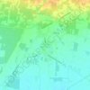
Arienzo topographic map

Click on the map to display elevation.

About this map

Name: Arienzo topographic map, elevation, terrain.

Location: Arienzo, Caserta, Campania, 81021, Italia (40.99960 14.48349 41.05570 14.53352)

Average elevation: 321 m

Minimum elevation: 44 m

Maximum elevation: 815 m

Other topographic maps

Click on a map to view its topography, its elevation and its terrain.
Destra Volturno

Italia > Campania > Caserta > Castel Volturno

Average elevation: 1 m

Borgo Appio

Italia > Campania > Caserta > Grazzanise

Average elevation: 8 m

Sant'Andrea del Pizzone

Italia > Campania > Caserta

Average elevation: 15 m

Casola

Italia > Campania > Caserta > Caserta

Average elevation: 317 m

Pugliano

Italia > Campania > Caserta > Teano

Average elevation: 189 m

Sant'Agata

Italia > Campania > Caserta > Sessa Aurunca > Avezzano-Sorbello

Average elevation: 190 m

Vallelunga

Italia > Campania > Caserta > Gallo Matese

Average elevation: 783 m

Sepicciano

Italia > Campania > Caserta > Piedimonte Matese > Sepicciano

Average elevation: 315 m

Pellegrino

Italia > Campania > Caserta > Pontelatone

Average elevation: 194 m

Mezzano

Italia > Campania > Caserta > Caserta

Average elevation: 207 m

Gear up for your next adventure:

🧴Bear Spray Holster - Quick-access carry for essential Canadian wilderness safety
🧣Merino Neck Gaiter - Protects against wind, sun, and cold at high altitudes
🧤Insulated Winter Gloves - Heavy-duty protection for sub-zero Canadian adventures
🧴Insect Repellent - Protect yourself from bugs during outdoor adventures
🎒Hiking Backpack - Lightweight and ergonomic backpacks for day hikes or multi-day treks

As an Amazon Associate, this site earns from qualifying purchases at no extra cost to you.